





“Raul and Rafael, our pilots were just terrific. This was our first paragliding experience. They not only made it feel easy but also a lot of fun. Will do it again!!”
Rajaram
on Rosswald paragliding tandem in ValaisValais region · 3904
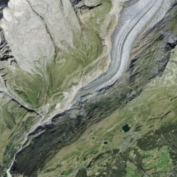
Naters is a municipality in Upper Valais, situated at 673 to 4195 m above sea level. The lowest point is on the banks of the Rhone and the highest point is reached by the Aletschhorn. Two thirds of the municipality of Naters is located in the UNESCO Swiss Alps Jungfrau-Aletsch World Heritage Site. In the old part of the village you can see many historically valuable buildings from the 12th-17th centuries. The village of Naters is a five-minute walk from Brig train station.
Mon0–10°Sunny
 Train travel to Naters
 Official SBB partner

Italy
from £114
Aerial image © swisstopo

Lauterbrunnen
from £428

Blatten bei Naters
from £114

Blatten bei Naters
from £124

Blatten bei Naters
from £2,328

Blatten bei Naters
from £741
“Raul and Rafael, our pilots were just terrific. This was our first paragliding experience. They not only made it feel easy but also a lot of fun. Will do it again!!”
Everything within a 30 min drive

Exhibition · Brig
Everything within a 90 min drive

Montreux
from £20
Everything within a 30 min drive
Brig · 9.4 km · 3 h 34 min

Birgisch → Eggen · 11 km · 4 h 52 min
Brig RB → Ried-Brig · 6.8 km · 2 h 30 min
Mörel · 8.8 km · 3 h 29 min
Mörel · 7.6 km · 2 h 41 min
Ried-Brig · 8.5 km · 2 h 53 min
Blatten b. Naters (Bushaltestelle Seilbahn) → Mörel Seilbahn · 8.3 km · 3 h 14 min
Termen · 5.6 km · 2 h 1 min
Everything within a 5 min drive

Bergwanderweg · Brig → Simplonpass · 12 km · 7 h 21 min
Wanderweg · Bitsch · 7.0 km · 2 h 27 min
Wanderweg · Bitsch · 6.5 km · 2 h 18 min
Wanderweg · Glis · 7.0 km · 2 h 22 min
Wanderweg · Brig → Ried-Brig · 5.1 km · 2 h 6 min
Wanderweg · Brig · 5.7 km · 1 h 51 min
Wanderweg · Brig · 13 km · 4 h 11 min
Everything within a 55 min drive
Everything within a 60 min drive
Zoo & animal park · Turtmann-Unterems
Everything within a 45 min drive
Everything within a 95 min drive
Panoramic transport · Brig
Panoramic transport · Meiringen

Journal

Journal

Alpi knows the best experiences on the ground and builds you a route to match.


